Measuring History: The Legacy of Gunter’s Chain in Surveying

Gunter’s Chain, a historical unit of measurement used in surveying, has had a lasting impact on the field of land surveying. This article explores the origin, evolution, advantages, and limitations of Gunter’s Chain, as well as its legacy in modern surveying practices. Key Takeaways Gunter’s Chain played a significant role in the standardization of measurements … Read more

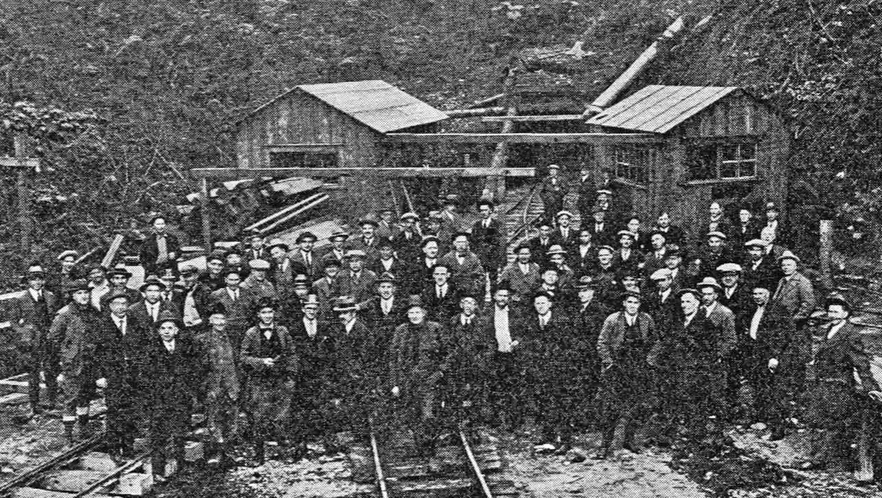
Bog Iron Extraction: A Historical Perspective

Bog iron extraction has a rich historical background that dates back to ancient times. This article explores the origins of bog iron extraction, technological advancements in the industry, and the environmental considerations associated with this process. Key Takeaways Bog iron extraction has played a significant role in local economies throughout history. Technological advancements have led … Read more

Slithering Suburbs: Coping with Snakes in Houston, Texas

Living in Houston, Texas, means dealing with the presence of snakes in suburban areas. Whether venomous or non-venomous, encountering snakes can be a common occurrence. In this article, we will explore how to identify common snakes in Houston, preventive measures to avoid snake encounters, and how to safely deal with snake encounters when they arise. … Read more

Which Continent Has Most of the Fresh Water On Earth?

which continent has most of the fresh water on earth

Antarctica holds most of the fresh water on earth. About 90% percent of the world’s total fresh water is frozen in Antarctica. Antarctica is the coldest, driest, and windiest continent on earth, and also has the highest average elevation. The first confirmed sighting of Antarctica is believed to have occurred in 1820 by the Russian … Read more

How Many Different Ecosystems Are There In the Olympic Peninsula In Western Washington State?

how many different ecosystems are there in the olympic peninsula in western washington state

Three completely different ecosystems can be found in the Olympic Peninsula in western Washington state. Dozens of glacier capped mountains, 60 miles (97 km) of undeveloped Pacific coastline, and old growth and temperate rain forests. Most of this region lies with the boundaries of Olympic National Park, 95 percent of which is designated as wilderness … Read more

How Many Islands Are There In Puget Sound In Washington and Who Is Puget Sound Named After?

how many islands are there in puget sound in washington and who is puget sound named after

About 170 islands make up the San Juan group in Puget Sound. Puget Sound, in northwestern Washington State, is a Pacific Ocean inlet that runs through the state for about 100 miles, (161 km) from Whidbey Island south to Olympia, Washington. Large ships can travel through the sound to several important port cities, including Seattle, … Read more

How Did the Oregon Trail Become the Major Trade and Migration Route For Settlers In the Pacific Northwest?

how did the oregon trail become the major trade and migration route for settlers in the pacific northwest

The Oregon Trail was a 2,000-mile (3,220-km) route through dangerous and rugged land was the “road” settlers took out of Independence, Missouri, to the Columbia River region of Oregon. The end of the trail was Oregon City, south of Portland. To go that distance in the mid-1800s took 4 to 6 months. People heading to … Read more

Why Do Urban Planners Consider Portland, Oregon To Be a Model City?

why do urban planners consider portland oregon to be a model city

Urban planners consider Portland, Oregon to be a model city because Portland has been so successful in revitalizing its downtown area and limiting urban sprawl. Its light-rail transit system has reduced traffic congestion and air pollution, and coordinated land-use planning has kept the city from spreading uncontrolled into the surrounding countryside. Unlike many U.S. cities, … Read more

Why Is Waimea Canyon In Kauai Known As the Grand Canyon of the Pacific?

why is waimea canyon in kauai known as the grand canyon of the pacific

The Hawaiian island of Kauai may be best known for its tropical gardens, but its dramatically beautiful Waimea canyon is the highlight of any visit there. Mark Twain once called this 10-mile (16-km)-long, 2-mile (3.2-km)-wide, and nearly 3,000-foot (914-m)-deep canyon the “Grand Canyon of the Pacific.” Its red rock walls remind visitors of Arizona’s Grand … Read more

What Are the Names of the Eight Main Hawaiian Islands?

what are the names of the eight main hawaiian islands scaled

Going from east to west, the names of the eight main Hawaiian Islands are: Hawaii, Maui, Kahoolawe, Lanai, Molokai, Oahu, Kauai, and Niihau. The Hawaiian Islands were once called the Sandwich Islands. Captain James Cook named them the “Sandwich Islands” in 1778 in honor of John Montagu, 4th Earl of Sandwich, who was one of … Read more

What Is the Most Isolated Grouping of Islands On Earth and How Did the Hawaiian Islands Form?

what is the most isolated grouping of islands on earth and how did the hawaiian islands form scaled

The Hawaiian Island archipelago is the most isolated grouping of islands on earth. The islands are really the tips of ancient volcanoes. They owe their existence to their location over an unusual stationary “hot spot” deep within the Earth in this area. As the Pacific tectonic plate slowly moved northwestward over that hot spot, molten … Read more

Why Does San Francisco Experience So Much Fog In the Summertime?

why does san francisco experience so much fog in the summertime scaled

When warm, humid air from the Pacific Ocean moves over the cooler water of San Francisco Bay it condenses, producing advection fog. This is the type of fog San Francisco experiences in the summer months, keeping the city cool, at least until it burns off around midday. San Francisco’s climate is characteristic of the cool-summer … Read more

What Was the Worst Earthquake To Hit California In the Twentieth Century?

what was the worst earthquake to hit california in the twentieth century

The 1906 San Francisco earthquake was the worst in California’s history, causing the deaths of more than 3,000 people and the destruction of 28,000 buildings. The fire that resulted made things worse, burning much of the city. Firefighters couldn’t fight the fires because the earthquake caused the water pipes leading into the city to break. … Read more

Why Is the Seagull the State Bird of Utah and How Did the Miracle of the Gulls Save Utah?

why is the seagull the state bird of utah and how did the miracle of the gulls save utah scaled

Back in 1848, Utah was invaded by millions of Rocky Mountain crickets that began destroying crops and threatening the people with starvation. Seemingly out of nowhere, flocks of California gulls appeared and began eating the crickets. The people were so grateful that more than a hundred years later this species of gull was selected as … Read more

Why Did the Mormons Settle In Utah and When Did Brigham Young Build a Settlement In Great Salt Lake City?

why did the mormons settle in utah and when did brigham young build a settlement in great salt lake city

Back in New York in 1830, a man named Joseph Smith established the Church of Jesus Christ of Latter-day Saints. Over the next 20 years, the church spread to Ohio, Missouri, and Illinois, but everywhere they went, its members were persecuted by people of other denominations. In 1847 they decided to travel west to find … Read more

Why Is Nevada Known As the Battle Born State and How Did Nevada Get Its Nickname?

why is nevada known as the battle born state and how did nevada get its nickname

The words “Battle Born” appear on the Nevada state flag because Nevada was admitted to the Union in 1864, during the Civil War. President Abraham Lincoln needed another Republican state to help support his antislavery policies in Congress. Even though Nevada didn’t have the required number of people to form a state, people in Nevada … Read more

Where Is Silicon Valley Located In California and How Did Silicon Valley Get Its Name?

where is silicon valley located in california and how did silicon valley get its name

Silicon Valley is a 30-mile (48-km) by 10-mile (16-km) area in northern California between San Francisco and San Jose. Its name comes from the many electronics, information technology, and Internet companies that have been locating their offices and manufacturing plants there since the 1950s. The term “Silicon Valley” was first used in 1971, with “silicon” … Read more

Why Is Tucson Arizona Known As the Astronomy Capital of the World and What Does Tucson Mean In Spanish?

why is tucson arizona known as the astronomy capital of the world and what does tucson mean in spanish

The mountain peaks around Tucson have the largest concentration of telescopes anywhere in the world. About 30 optical telescopes, including those at Lowell Observatory and Kitt Peak National Observatory, study the stars and planets from this part of the Arizona desert, where dark night skies and dry desert air give astronomers good views of the … Read more

How Did Petrified Forest National Park In Northeastern Arizona Form and How Did It Get Its Name?

how did petrified forest national park in northeastern arizona form and how did it get its name

More than 225 million years ago, trees then growing in Petrified Forest National Park in northeastern Arizona were buried in volcanic ash, mud, or sand and eventually turned to stone. Today the area, within the Painted Desert, another colorful part of Arizona, contains one of the world’s largest concentrations of petrified wood. The park covers … Read more

How Many Glaciers Are There At Glacier National Park In Montana?

how many glaciers are there at glacier national park in montana

Glacier National Park features more than 50 glaciers and 200 lakes and streams in its 1.4 million mountainous acres (560,000 ha). The park also has more than one thousand different species of plants and animals. The mountains of Glacier National Park began forming about 170 million years ago when ancient rocks were forced over much … Read more

What Makes the Rivers In Montana Unique Among the 50 States?

what makes the rivers in montana unique among the 50 states

Montana’s rivers flow into three widely separated bodies of water: the Gulf of Mexico the Pacific Ocean the Hudson Bay The Missouri River system drains into the Mississippi River and then into the Gulf of Mexico. The Columbia River system drains into the Pacific Ocean. The Belly, St. Mary’s, and Waterton Rivers drain into Hudson … Read more

How Did Grasshopper Glacier In Montana Get Its Name and Where Did the Locusts Come From?

how did grasshopper glacier in montana get its name and where did the locusts come from

Grasshopper Glacier, in the Beartooth Mountains in Montana, is a most unusual natural phenomenon. Huge swarms of grasshoppers have been trapped in the ice of a glacier for more than 300 years. This oddity was discovered in 1898 during a scientific expedition in the northern Rockies near Granite Peak, not far from Yellowstone National Park. … Read more

Why Is Lewiston Idaho Called the Seaport of Idaho and Who Is the City of Lewiston Named After?

why is lewiston idaho called the seaport of idaho and who is the city of lewiston named after scaled

Lewiston, Idaho, sometimes called the Seaport of Idaho, is really a riverport at the confluence of the Snake and Clearwater Rivers. Boats and barges carry farm and forest products down to the Columbia River and through neighboring Washington State to the Pacific Ocean, a journey of 465 miles (749 km). Lewiston was one of Idaho’s … Read more

How Many Different National Flags Have Flown Over Texas?

how many different national flags have flown over texas scaled

Six different national flags have flown over Texas. At various times in its history, parts of the area that now form the state of Texas belonged at different times to Spain, France, and Mexico, its first three flags. After gaining independence from Mexico in 1836, Texas became an independent nation, the Republic of Texas, and … Read more

What Is the Longest Barrier Island In the World and How Long Is Padre Island On the South Texas Coast?

what is the longest barrier island in the world and how long is padre island on the south texas coast

Padre Island runs along the South Texas coast, and is the longest barrier island in the world. The U.S. National Park Service has designated nearly 70 miles (113 km) of the 130-mile (209-km) island as Padre Island National Seashore. Barrier islands are one of four basic types of islands; the others are continental, oceanic, and … Read more

How Flat Is Texas and Is All of Texas Flat or Are There Mountains In the State?

how flat is texas and is all of texas flat or are there mountains in the state scaled

Discover the topography of Texas as we delve into its landscapes. From vast plains to hidden peaks, explore the diverse geography shaping the Lone Star State’s unique character. Key Takeaway: Texas boasts a varied terrain, encompassing flat expanses and rugged mountains, providing a captivating blend of landscapes for nature enthusiasts. Most parts of the state … Read more

How Many Diamond Mines Are There In the United States?

how many diamond mines are there in the united states

There is just one diamond mine in the United States, in Murfreesboro, Arkansas. Visitors can hunt for and keep any diamonds they find there. Diamonds were discovered in 1906 in Crater of Diamonds State Park, and by 1933, about 100,000 were found. The 1,000 year old Ka-Do-Ha Indian Village and museum is also located in … Read more

Where Is the City of Texarkana Located and Is the City of Texarkana In Texas Or Arkansas?

where is the city of texarkana located and is the city of texarkana in texas or arkansas

The city of Texarkana in Texas straddles the border of Texas and Arkansas. Although it has two city governments, one in each state, it has just one post office. Its address reads “Texarkana, Arkansas-Texas.” Also known as AR Metropolitan Statistical Area (MSA), Texarkana was founded in 1873 on the junction of two railroads. The Texarkana … Read more

Which City In the United States Has the Busiest Port and How Big Is the Port of South Louisiana?

which city in the united states has the busiest port and how big is the port of south louisiana scaled

The Port of South Louisiana, outside New Orleans, Louisiana, is the nation’s busiest port and the world’s third busiest, when measured by tonnage handled. The port is huge, extending 54 miles (87 km) along the Mississippi River. More than 4,000 oceangoing vessels call there each year. Most shipments leaving the port are corn, wheat, and … Read more

How Many Native Americans Still Live In Oklahoma and Which Tribes Did They Descend From?

how many native americans still live in oklahoma and which tribes did they descend from

Oklahoma is home to about 272,000 Native Americans, who make up almost 8 percent of the population. Many are descended from the 67 tribes that lived there when the state was Indian Territory. These tribes included the Cherokee, Choctaw, Chickasaw, Creek, Seminole, Osage, Cheyenne, Sac and Fox, Delaware, Apache, and Pawnee. The southwestern states is … Read more

How Far Is Florida From Cuba At Its Closest Point?

how far is florida from cuba at its closest point

The southern tip of Florida is less than 100 miles (161 km) from the island nation of Cuba. Ever since Cuba became a Communist nation in the early 1960s, some of its citizens have tried to escape political oppression by sailing on small boats to the United States. Many Cubans have settled in the cities … Read more

Where Are the Everglades Located and Why Are the Everglades In Florida Endangered?

where are the everglades located and why are the everglades in florida endangered

The Everglades are swampy grasslands that cover southern Florida. Everglades National Park, which covers only a fifth of the Everglades region, was established to preserve this unusual ecosystem, for example, it is the only place in the world where alligators and crocodiles live together. The park covers 2,342 square miles (6,090 sq km). It is … Read more